Table of Contents
ToggleIn today’s rapidly evolving advertising landscape, Quick Service Restaurants (QSRs) are embracing data intelligence and geospatial technology to gain a competitive edge. As audiences become more mobile and digital, understanding where, when, and how to connect with them is becoming a key differentiator. One of the most powerful technologies in this transformation is location intelligence, particularly when visualized through isoline mapping and audience heatmaps.
This blog explores how QSRs across the MENA region can use these insights to power smarter marketing decisions, increase customer engagement, and future-proof their growth strategies.
What Is Location Intelligence and Why Is It Important for QSRs?
Location intelligence involves analyzing spatial data to uncover patterns about consumer behavior, movement, and intent. When applied to the QSR industry, this means understanding not just where your customers are, but also how far they’re willing to travel, their demographic profiles, and what kind of offers are likely to convert.
For a deeper dive into how location intelligence supports strategic decision-making, check out this Forbes article on leveraging location intelligence.
Top Benefits for QSRs:
- Identifying high-conversion zones for marketing campaigns
- Planning store expansions based on actual consumer movement
- Reducing ad spend waste through hyper-targeted activation
- Enhancing delivery and pick-up operations with real-time geofencing
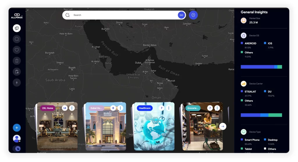
Additionally, platforms like AllPings provide advanced location intelligence solutions specifically tailored for performance-driven marketers. AllPings helps businesses harness mobility data and geospatial insights to refine their audience targeting strategies and boost conversion metrics.
Isoline Maps and Heatmaps: The Future of Hyperlocal Advertising
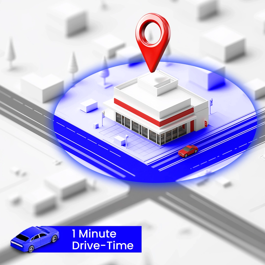
What is an Isoline map?
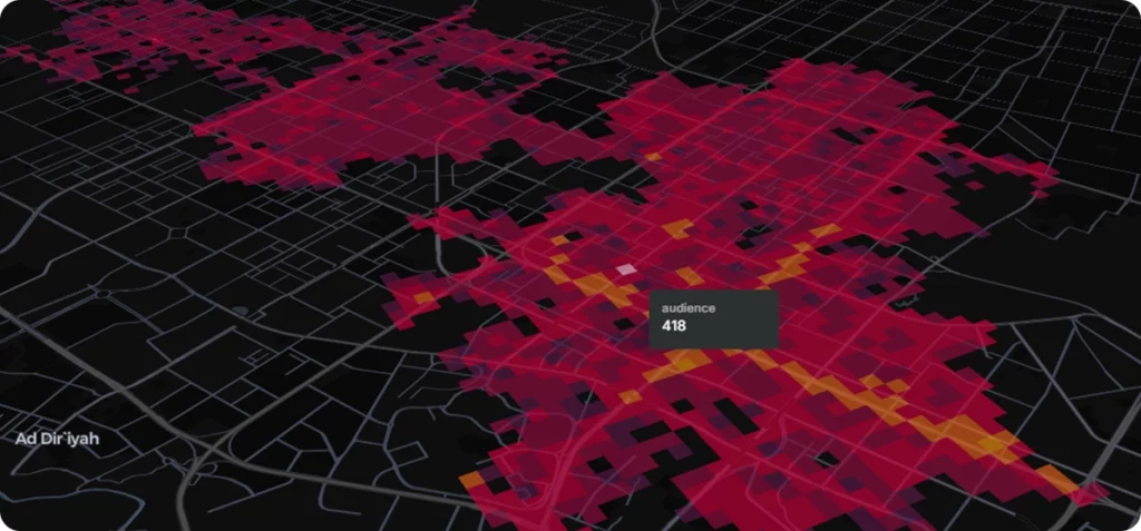
Isoline maps are a powerful methodology that connects points of equal value, such as travel time or distance, providing clarity in decision-making. These maps, often shown as 5-minute drive-time isoline polygons, help marketers visualize zones where users are most likely to convert.
For QSRs, this translates into:
To understand how isoline maps work and why they’re impactful, read this comprehensive Geoapify guide to isoline mapping.
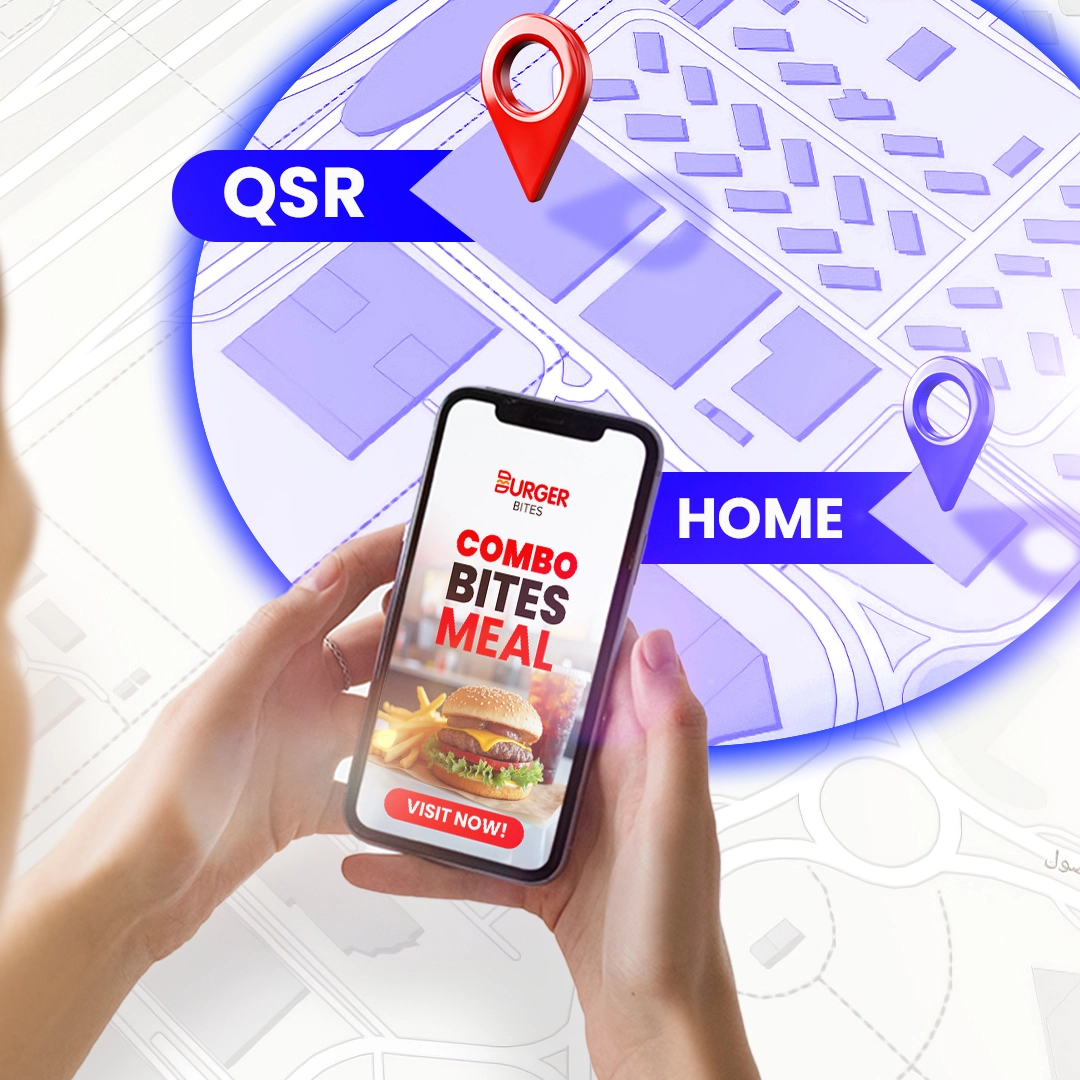
These methodologies allow brands to meet the customer in the moment, offering authentic engagement and improved ROI—what we call “The Advantage of Moment Marketing.”
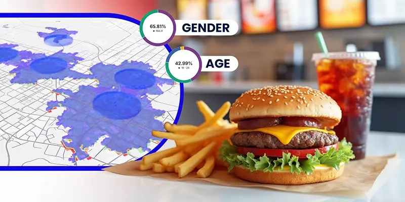
Demographic Insights: Data That Drives Real Decisions
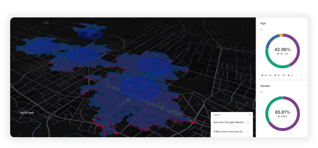
According to the sample dataset, over 42.99% of users fall within the 18–24 age group, with 65.81% identifying as male. These figures are crucial for QSRs aiming to create relevant, personalized marketing strategies. This demographic is tech-savvy, mobile-first, and driven by convenience, making it the ideal audience for geotargeted offers and app-based engagement.
Pairing this data with isoline insights allows brands to:
- Create campaign messaging that resonates with younger audiences
- Design digital content optimized for mobile and social platforms
- Choose media channels and formats based on consumer preferences
From Data to Action: Location Tech in Advertising
QSRs that harness geospatial technology, mobility data, and isoline maps bridge the physical and digital customer journey. This is critical as the MENA region continues to lead in smartphone penetration and mobile commerce growth
Key Applications:
- Geofenced push notifications for limited-time offers
- Location-based rewards and loyalty programs
- Dynamic creative optimization based on real-time movement data
Isoline Mapping in Action: Methodology and Examples
Leading technology platforms like AllPings offer tools to create isoline maps. These maps are used in fields from urban planning to weather prediction, but they’re especially useful in QSR marketing. QSRs can use these to plan store networks, target delivery areas, or design geo-fenced ad campaigns.
Types of Isoline Maps:
- Contour maps: Show elevation levels
- Isochrones: Shows areas reachable within a specific time
- Isodistances: Show areas reachable within a specific distance
Preparing for the Future with Ethical Data. As new privacy laws tighten data use, QSRs need to rely more on first-party and zero-party data—data users willingly share. Isoline mapping helps visualize that data ethically and usefully.
QSRs that succeed will:
- Use consented location data for smarter targeting.
- Build campaigns based on real user movement.
- Stay ahead of data regulations while earning trust.
Isoline maps connect points of equal value—like time or distance—and tell a story. For QSR marketers, that story is about being at the right place at the right time with the right message.
With AllPings Location Intelligence, isoline mapping, and smart tech tools, QSRs can not only compete—but lead. Want to learn how isoline maps can unlock smarter growth for your QSR brand? Contact us!
Frequently Asked Questions (FAQs)
-
1. What is isoline mapping in QSR marketing?
Isoline mapping is a geospatial methodology that shows areas based on travel time or distance from a location. In QSR marketing, it helps brands target customers who are most likely to visit or order based on proximity.
-
2. How do isoline maps help QSRs increase sales?
They highlight high-conversion zones where customers are more likely to respond to promotions. This allows QSRs to target marketing efforts more precisely and reduce wasted ad spend.
-
3. How does AllPings support QSR growth through location data?
AllPings provides performance-driven marketers with access to advanced location intelligence, enabling them to target audiences based on real movement patterns, optimize media spend, and drive higher conversion rates
-
4. How can I start using isoline maps for my QSR?
You can contact us at marketing@memob.com to learn how location tech and isoline mapping can help boost engagement and drive growth for your restaurant business.